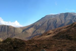
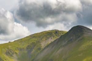
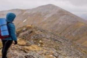
The UK has some of the best walking and hiking in the world. If you want a challenge, how about Scafell Pike which is the tallest mountain in England, or Snowdon, the tallest mountain in Wales, or even Ben Nevis, the tallest mountain in Scotland. A challenge doesn’t just have to be climbing a mountain. Across the UK there are some fantastic walks that offer a real challenge, but on flat surface.
In this blog post, we’re looking at ten of our favorite coastal walks across the UK. None of these are very difficult routes, however if you enjoy the coastline, the sea and wildlife near the ocean, you’re going to love these routes.
Knoll Beach, Studland, to Lulworth Cove, Dorset
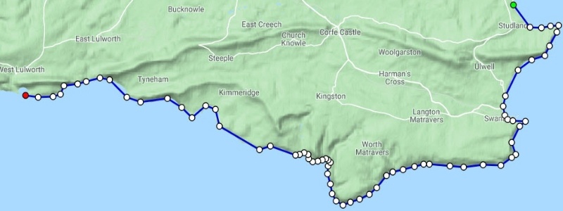
Distance 26 miles
Time 10 hours / 1-2 Days
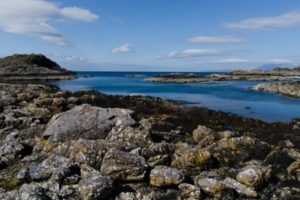
The Dorset and East Devon Coast contain some of the best coastal countryside the UK has to offer. The area has everything from white sandy beaches and plunging cliff paths, to fantastic history. It’s said the area has so much history that in about 90 miles, you can walk though 180 million years of history. The reserve is also home to many animals including some threatened species such as landybird spider, lizards and nightjar.
This walk is one of the best on the South Coast of England and while it’s possible to walk it in one long day, it’s much better to break the walk up into two days.
Church Bay to Moelfre, Anglesey
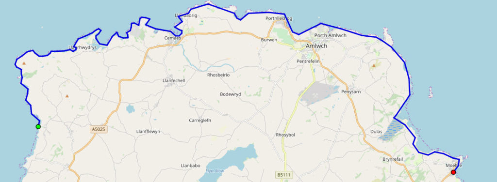
Distance 25 miles
Time 13 hours / 2 Days
Walking along Coast near South Stack Lighthouse, Anglesey is of the best areas in Northwest Wales as the area consists of empty land of whitewashed buildings and rolling green fields. In all honesty it feels more like Cornwall than Wales if the weather is right. This walk is another walk that is probably best to take two days over. While it’s flat land along the coast, 25 miles is still a long walk for one day.
The walk starts off in the area off in Church Bay on the west side of Anglesey and literially walks around the northern point of the island to an area around Moelfre Beach. The coastline sets this island apart and is made up of pebble beaches and dunes to the north, fields on the south, sandy bays and undulating cliff terrain. The highlights include the Chemlyn nature reserve, Holy Island, Point Lyans lighthouse, sea stacks and caves. There
Lochranza to Sannox, Isle of Arran
Distance 6 miles
Time – 3 Hours
The Isle of Arran is located just off the coast of south Scotland next to Glasgow and is an outstanding area of nature to such an extent that it’s usually described as Scotland in miniature. There is a mix of almost everything exciting in this area including a mountainous region that consists of small scattered coastal communities, beautiful bays and epic beaches. If it rains, and it probably will given you’re in the west of Scotland, there are a few things to do including visiting the brewery near Brodick or the Heritage Museum.
The walks in this area are mostly short, between four and 8 miles, and either consist of walking along the coastline, or through the mountainous regions in the center of the island.
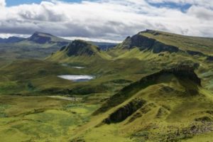
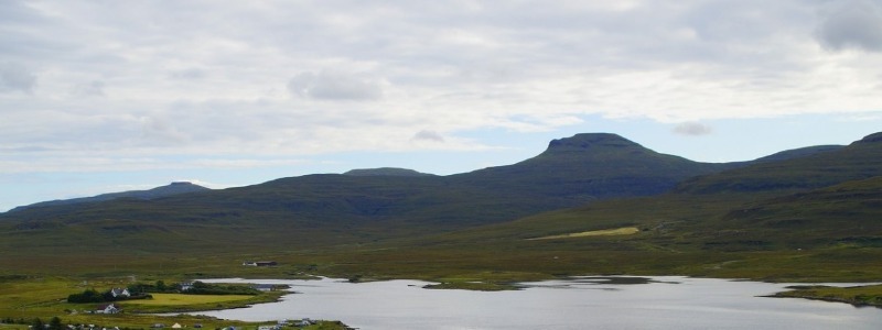
Glen Brittle to Rubh’an Dnain, Isle of Skye
Distance – 9 Miles
Time – 6 Hours
The Isle of Skye is probably the most beautiful part of Scotland when it’s not raining and has some of the best walks and hikes across Scotland. While there are lots of coastals route, the great thing about this area is that on any particular route across the island, you will always be less than five miles (eight kilometers) from the sea.
This route starts off at the Fairy Pools next to Glen Brittle and heads south, along the River Brittle down the most South-Western part of the island at Rubh’an Dnain. Its a route of about 8 miles, that should not take more than six hours to complete. While there are some more varied coastal walking opportunities on the island, this route consists of rough vegetation and rocky outcrops which are complimented by the few boggy sections.
Lynton to Croyde, North Devon
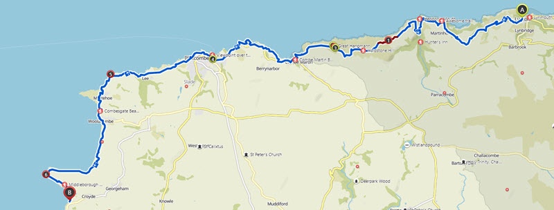
Distance 30 miles
Time 20 hours / 2 Days
This section of the North Devon coast contains rigorous but stimulating walks. The area contains the highest area of the South West coast, however there are numerous coves and bays which are complimented by epic pockets of woodland.
This walk starts in Lynton which is an interesting, but small, clifftop town that is separated from Lynmouth, which is its village neighbor, by a 150-meter drop. The areas are connected by a water powered cliff railway. One of the best things in this area is the superb views to South Wales and the Gower peninsula. The end point of this walk is Croyde which is a village on the west coastline of North Devon. The village is close to Baggy Point and part of the North Devon Coast Area of Outstanding Natural Beauty.
Burnham Deepdale to Sheringham, North Norfolk
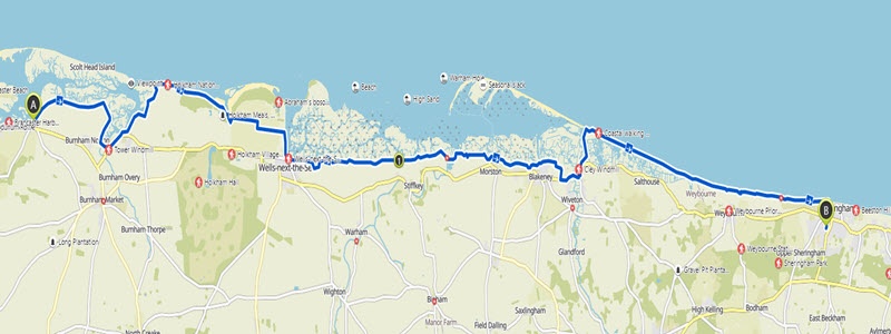
Distance – 30 Miles
Time – 15 Hours (Two-Day Hike)
This is one of my favorite walks in Norfolk starting in Burnham, just below the Scolt Head Island National Nature Reserve and finishing in Sheringham. The walk is about 30 miles long, and thus best two walk over two days, with either the option of camping overnight in a local campsite, wild camping or even a night in a local B&B.
The trail of the walk is simple where you can follow the clear tracks on top of the sea banks or along the edge of the mash. All what you need is to always keep the sea on your left while walking.
The scenery is brilliant, there are mudflats and tidal saltmarshes along the atmospheric and wild Norfolk shores which are further riddled with inlets and creeks. You can also enjoy the crumbling cliffs, the constantly shifting shingle banks and sandy beaches.
Sandwood Bay, Sutherland
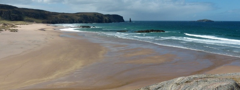
Distance – 5 Miles
Time – 4 Hours
Sandwood Bay in Northern Scotland, is best known for it’s almost two miles of spotless white sand that is complimented by rolling dunes and chiseled rocks on either sides. While here, you need to make sure you visit Cape Wrath which is located on the north-west tip of the British mainland.
The walk starts about files miles south of the beach where to start the walk you need walk about five miles along a rough moorland track. There is a lively fish market which is open everyday in Kinlochbervie and the crafting community of Oldshoremore which is nearby has a beach of its own and is worth a visit.
Scarborough to Staithes North Yorkshire
Distance 34 Miles
Time 17 Hours (Two-Day Hike)
This walk is a bit challenging but it will give you a spectacular view of the Yorkshire coast that includes high level cliff paths and areas of cliff erosion with steep flights. The route starts in Scarborough and heads north past the old guesthouses.
As you climb up the coastal path, you will be able to see the coastguard lookouts and grass farmland. Robin Hood’s Bay, The Ravenscar estate, The straithes and the attractions at Whiteby’s spooky are all great things to see along this route.
Eastbourne to Seaford, Sussex
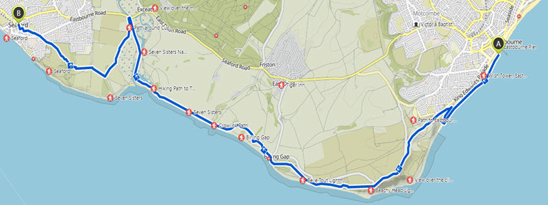
Distance 15 Miles
Time 8 hours
This is a brilliant day walk from Eastbourne which is a typical 1930’s beach town resort made famous by the Victorian hotels located on the seafront, the 19th-century Eastbourne Pier and a 1930s bandstand, to Seaford which in the middle ages was one of the main ports serving Southern England.
The walk is actually a very easy walk even though its likely to take the full day to walk the route. That said, there are some of the best views that you’re going to find on the south coast including the Seven Sisters and the billowing chalk down-land of Beachy Head. If you really want a great walk along the south coast of England, consider the south downs way which run from Eastbourne to Winchester for a total distance of about 100 miles. This is effectively the first 15 miles of this route.
Porthcurno to St Ives, West Cornwall
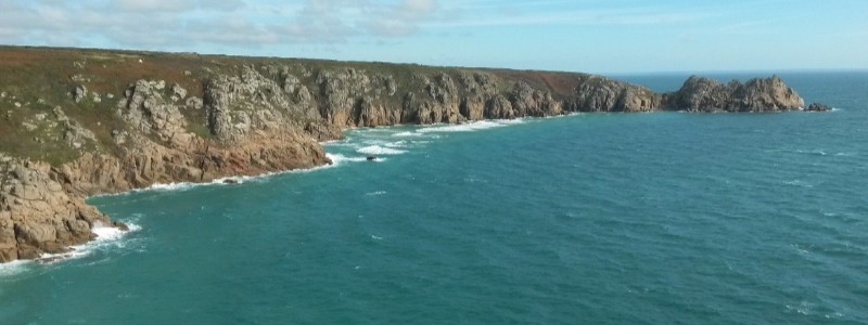
Distance 29 Miles
Time 2 Days
This has to be one of the top two walks in the UK today. Not because it’s a fantastic walk , but because it passes past lands end and the most southerly point of the UK. In all honesty, the Land’s End Landmark Attraction is nothing special, but the fact that you’ve walked past lands end, for me is a huge achievment.
The route starts in Porthcurno tot he East of Lands end. On the initial stages of the walk you will pass the Minack Theatre which is an open air amphitheater that was fashioned out of the cliffs in the 1930s. You will also get to pass through the stunning and tinny cove of Porth Chapel and a tiny village known as Porthgwarra.
Once you’re through Prthgwarra, its nothing but headlands, sandy bays, soaring cliffs and the Atlantic Ocean crashing into the rocks at your feet. The area is full of migrant birds and a profusion of flowers. The path along the coast gives you an opportunity to enjoy a challenging clifftop journey to the end of the land. From here you can break the long walk by either camping or staying in one of the many B&B’s along the route. Its up to you whether you want a two day trip, or a three. Personally, we stayed one night in a campsite in Morvah, and then arrived late into St Ives and staying in a local B&B for the second night.