- Distance – 4.8 Miles
- Ascent– 900ft / 274 Meters
- Highest Point – N/A
- Time Taken – Three Hours
- Difficulty – Easy
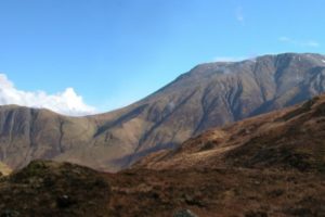
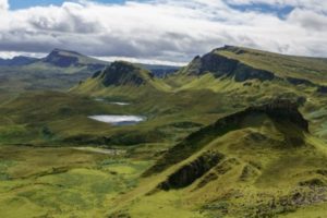
The Isle of Skye is a fantastic place to visit and has some of the best walking, camping and mountaineering, the UK has to offer. The Isle of Skye is commonly referred to as the “the garden of the Skye” as it has forest-covered mountains that drop quickly and sharply down to the ocean.
The Island is not only home to some of the best walking in the UK, but also to some fantastic restaurants, hotels and beaches with rocky shorelines meaning that if the weather plays it’s part, then you can have a lot of fun.
If you’re going to plan a trip to the Isle of Skye, make sure you book early. Accommodation fills up quickly across Scotland and especially so, across the Isle of Skye. There is the possibility to pitch your tent both directly in the countryside and at more formal camping sites across Skye.
The Walk
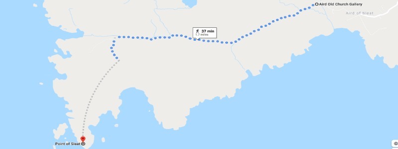
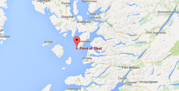
The plan was to have a leisurely walk from the Car Park (which is just to the right of Aird Old Church Gallery) to the very southernmost point of Skye. The walk is about five miles long, and because it’s relatively flat (there is less than 100 feet in height difference), it’s straightforward and takes around an hour and a half each way.
While there is a marked path, two-thirds of the walk is on a wide, stony track and the remainder on a dirt and grass footpath that’s quite uneven and boggy in places. There is one steep section that only lasts for 50-meters (there was a five-year-old child that ran up it without problems) but offers fantastic views of the Aird crofting township, then out over the sea to the mainland town of Mallaig.
The Split
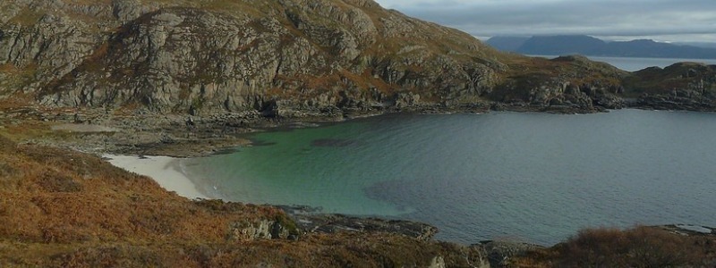
After about two miles, the route split in two directions. To the south, the path takes you to a fantastic, white sandy beach called ‘Camas Daraich‘. When the tide is out white sand is revealed, and there are lots of small rock pools and beautiful rock formations.
If you carry onwards to the southwest, you after a little while, you reach the lighthouse at Point of Sleat. This is the most southern point of the Isle of Skye and offers some breathtaking views out to sea. You can see the small isles of Rum, Canna and Eigg.
The Walk Home
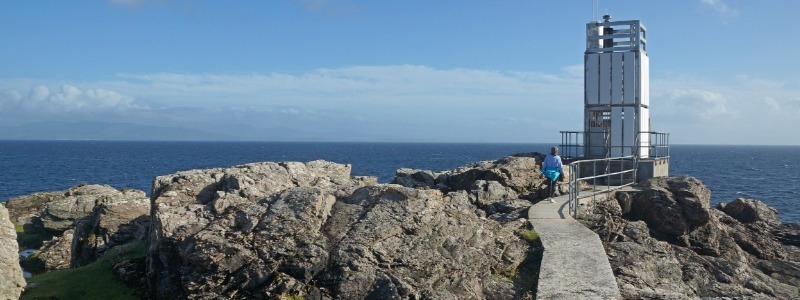
The lighthouse dates back to 1938 when it was first established as a manned lighthouse. Sadly the old lighthouse has been replaced in 2003 with a modern, unmanned and completely automatic version. It might do the job, but it doesn’t look great. When I first heard about the lighthouse, I had images of a huge, century-old lighthouse that would be a fantastic picture.
If the tide is out, it’s possible to walk from the lighthouse back to the beach which offers some great views. If you’re brave, you could always take a swim in the ocean, however only in the summer. It’s freezing cold in the winter.
Drone Footage
This Drone Footage courtesy of JagerScot, shows the entire route to include both the white sandy beach called ‘Camas Daraich’, and the unmanned and completely automatic lighthouse at the southern most tip of the The Isle of Skye, Point Of Sleat.