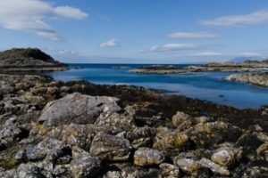
Ben Nevis is the tallest mountain in both Scotland and the British Isles. It has a summit of 1,345 metres (4,413 ft) above sea level. The mountain is located at the western wide of the Grampian Mountain range in Scottish Highlands.
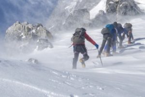
Given it’s statue, every year more the 150,000 people try to climb it, with the majority taking the Pony Track from Glen Nevis, however there are five other routes that range in difficulties from easy, to very difficult.
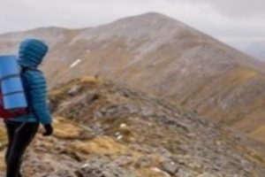
If you’re going to hike up Ben Nevis, which path should you take? Which trail you choose relies heavily on the experience you have a trail trekker. You should not be taking trails meant for experts as a beginner, no matter how good you think you are. So, let’s break down the six paths, and dissect their attributes so you can pick the one best for you!
The Mountain Track
The Mountain Track is referred to by some as the easiest trail up Ben Nevis, although it is in no way a stroll through a sunny park with a fine lady and small fluffy dog. This trail starts at sea level, and climbs all the way to the top, so you are looking at a 1300 metres (or 9 km) hike. It is not an easy route.
For this trail, you will need to be highly aware of your surroundings and where you are, because if mist sets in, you can end up taking a wrong turn very easily and ending up in a different location. The total height of this hike is 1370 metres, with a distance total of 17 km. This trail is not quick, and it clocks in at about 8 hours to complete. Again, do not be fooled by the label of “easiest climb.” It might be the easiest, but it is still very difficult.
The Ledge Route
This scramble-hike is quicker than the mountain trail, but only allows travel one way. The total height of this climb goes up 1300 metres, and has a collective distance traveled of 8 km. It only takes about 4 or 5 hours to complete, but that should not convince you that it is an easy trail. This trail track around the North Face and up to Carn Dearg and then continues to the summit.
You can begin this trail at the CIC Hut and can be started properly from the car park on the North Face or Glen Nevis. Just like the other routes, this trail should be looked at carefully, and you should know what you are doing before you get into it. There can be patches of snow well into the summer months, although they can usually be seen from the bottom of the mountain, so you can arrange accordingly.
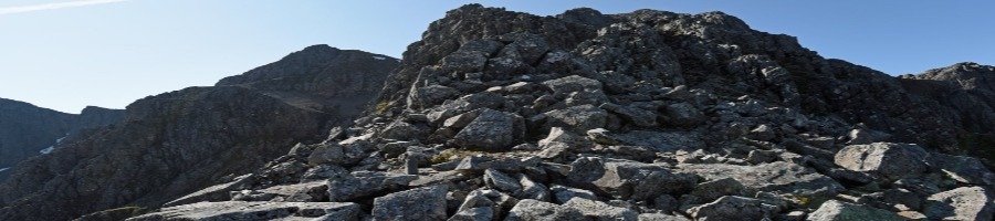
The Carn Mor Dearg Arete
This trail has a height gain of 1500 metres, and a total distance of a whopping 18 km! It typically takes more than 8 hours to complete, making it a longer and perhaps tedious trail to hike. It is often nicknamed the CMD to shorten the long name, but it is considered one of the best trails in the mountains of the United Kingdom. It is a grade 1 scramble, and fairly straightforward, so it does not involve a crazy amount of prep.
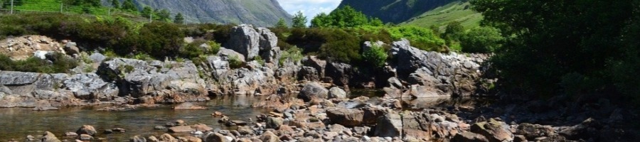
There is a huge ridge with a fairly sheer scale, that does not make you as exposed as other trails. This larger scale can really get you sore after you have already hiked up 1200 metres! (You’ll feel it in your calves tomorrow!) Typically, you can start the CMD trail from the North Face Car Park by Torlundy. You can walk up the CMD from Glen Nevis, but it does involve a river crossing. There is an East Ridge that starts by the Steall Falls Car Park at the finishing point of Glen Nevis, which takes you further on Glen Nevis.
Steall Falls
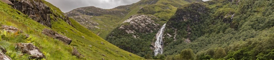
Those of you who want a unique or alternative hike, check out the Steall Falls trail! Be warned, this trail is extremely difficult and is for pros. This route has you ascend from the South of Ben Nevis, and get a height gained of 1200 metres. It is a total distance of 4.4 km and is quick at four hours, however, it is one way only.
The straightforward route is from Carn Dearg, but from the South side, and is very steep. Even though the distance is only 4.4 km, the terrain is brutal and very difficult to cross. Not many people shoes this route, simply due to the craziness of the terrain. Once you hit the summit, you can descend the mountain from the Southern blunt ridge down to Bealach Cumhann.
Make sure you know where you are headed, and be careful! This route is for experienced trekkers, and should not be played with!
Carn Mor Dearg Arete From Glen Nevis
This trail, although similar to the CMD, is a slightly different route than the CMD. It is an alternative approach to the CMD trail. Instead of starting at the usual CMD North Face Car Park, this trail begins at Glen Nevis, and provides a 19.6 km total distance, and a height gain of 1739 metres!
This trail is another long one, at around 8 hours to complete. It starts and finishes at the Glen Nevis Vistors Centre. There is a long section of grade one scrambling and is a challenging trek.Hikers have consistently said that the views were stunning from this climb, and rave about the reward of the summit. Be warned, this trail in poor weather does not make for a fun time. Be sure to be prepared.
The Pony Track
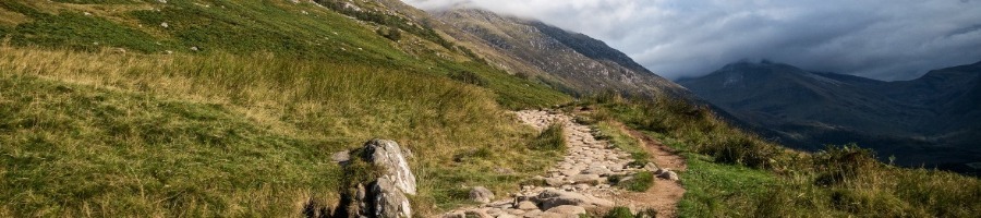
The pony track is also called the tourist track because it is the simplest of the trails, and most beginners find it perfect for them. The main path runs up Ben Nevis and originates from Glen Nevis. You can find the beginning at the Glen Nevis Visitors Centre. The path continues to Lochan Meall an t-Siudhe. At the halfway point the path begins to zig and zag, making it slightly more difficult than it had been, but then straightens out for the last stretch.
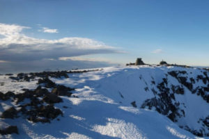
Towards the summit, large cairns mark that you are reaching the end! (These markers may be obscured by snow in the early spring months, so be aware.) This trail is 17 km up and down, and is 1352 metres of height!