Route Statistics
- Distance – 8.2 Miles
- Ascent– 126 Ft
- Highest Point – High Willhays 621 metres (2,039 feet)
- Time Taken – Six Hours
- Difficulty – Medium
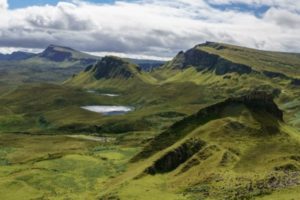
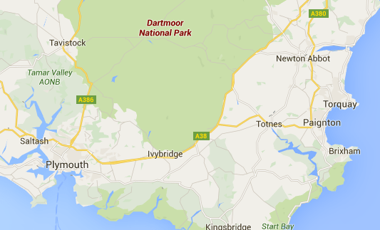
Dartmoor covers 954 Square Miles of space in Devon, South West England and is considered one of the UK’s finest National Parks and is not only a popular tourist destination but also used by the British Army as a firing range for the last 200 years.
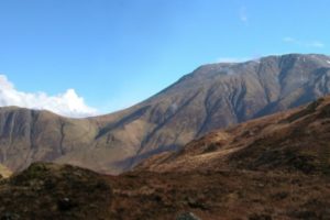
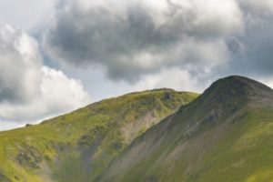
The area is known for it’s “Tors” (Hills Topped with an OutCrops of Bedrock). Over the years, we have walked quite lot in this National Park. One of my favorite walks in the Yes Tor which is the second highest point on Dartmoor, at 619 metres (2,031 ft) and High Willhays which is considered the highest point on Dartmoor at 621 metres (2,039 feet).
Dartmoor Bogs
While we could not possibly claim to have walked across the whole area during our trip, we made a three days trip to see some of the famous parts of this area to find out what they are really like.
The Dartmoor bogs are famous for two things, Tors with their own Ten Tors Challenge where up to 5,000 people each year take part in a walk of up to 100Km and Bogs, mainly due to the fact that more rain falls on this area of the National Park than anywhere else.
The Plan
The idea was that we were going to park the car in the Dartmoor National Visitor Centre car park as there is plenty of parking spaces available. We would then walk across Clapper Bridge in Postbridge, which is a medieval-era river-crossing made by laying huge slabs of granite over columns of smaller rock that have been stacked in the water nearly two hundred years ago.
From here, we headed south along the Dartmoor Way towards Laughter Tor, before heading North-West toward Bellever Tor before heading home through Bellever Moor and back to the visitor centre.
This walk is around eight-miles in total, and should not take more than five hours to complete. The route is relatively easy and gives an excellent opportunity to see both the Bogs and this Neolithic area of Dartmoor that has been freckled with this kind of proof of earlier habitation.
Laughter Tor
Once you leave the car park of the visitor centre, head due south towards bellever on one of the choices of pathways. There are a few to choose from, and it really doesn’t matter which one you choose as they basically end in the same place.
The route takes you through Bellever Meadows which is truly beautiful, and onwards towards Laughter Tor. Laughter Tor which derives from the old Dartmoor word “lough” which means to pile into mounds and is marked by a large stone structure known as the Laughter man (or more accurately, the Lough Tor Maen), which is easily visible.
The area around the Tor is fascinating, given it was used as an animal compound. Towards the south of Laughter Tor is an animal pound that was used in the past by moormen to count their sheep. Once the pen was full, there was no need to count them as they knew how many animals the pen held.
Bellever Tor
From laughter Tor, you need simply follow the pathway initially west towards Bellever Tor. The path is clear and given its only about a mile away, on a clear day, you can see it in the distance.
The route is not too challenging as there is only a slight gradient on the way down, and back up the to the Tor. One point to watch out for, at the bottom of the hill, there is a particularly boggy zone. You will need to take your time or risk getting stuck in bogs.
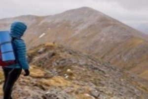
The Tor itself is 443m high and is clearly marked with a triangulation point on the summit, however, the real interest is the granite stacks that offer some fantastic opportunities for great views in all directions.
From the top of the Tor, there is a great view of Lych Way which is an ancient track that starts in Bellever and goes to Lydford, cutting through Powdermills and the Longaford Tors towards the north-west. The Lych Way, also known as the Corpse Road was the route the dead were taken for burial at Lydford. For Dartmoor residents, up until 1260, all burials had to take place at Lydford, and for those on the eastern side of the moor, the 12 miles (19km) route started at Bellever. After 1260, permission was given by Bishop Bronescombe to allow burials at Widecombe.
The Route Home
The route back to the car is clearly marked and given the path system, it’s very easy to walk on a different pathway than you walked on earlier. The walk home is also very easy, and very difficult to get lost or not end up back at the car park.
Finally
As with all our walks, I would highly recommend that you use the right equipment to stay safe in the countryside. Firstly walking boots are recommended over shoes, as they offer more ankle support. I would also recommend that you use walking poles and make sure you take your emergency and first aid pack in case you run into problems along the route.